


Aylesbury - Tring - Wendover - Street Plan With Index
Publisher: Garnett
Format: Paperback
ISBN: none
Aylesbury – Tring – Wendover: Street Plan with Index (c.1970) – Garnett
Garnett Publications | ISBN: None
Condition: Fair | Sold by Crappy Old Books
Aylesbury, Tring and Wendover. Three perfectly respectable English towns where market squares, historic churches, suburban streets and surrounding countryside have been quietly getting on with the business of existing for centuries. The sort of places where one might reasonably expect to enjoy a pleasant afternoon, provided one knows where one is going and doesn’t accidentally take the wrong turning towards Milton Keynes.
Fortunately, Garnett Publications anticipated precisely this difficulty.
Welcome to Aylesbury – Tring – Wendover: Street Plan with Index, a wonderfully nostalgic street guide dating from approximately 1970, when finding an unfamiliar address involved consulting a paper map, deciphering a street index and occasionally stopping to ask a complete stranger whether he knew where Acacia Avenue was.
The answer, naturally, was invariably yes, followed by a complicated explanation involving three left turns, a railway bridge, a public house that had changed its name in 1958 and a road that apparently no longer existed.
This charming little publication covers three distinctive communities on the borders of Buckinghamshire and Hertfordshire, offering street plans and an index intended to help motorists, visitors and local residents negotiate the increasingly complicated business of getting from one place to another.
Aylesbury, the historic county town of Buckinghamshire, provides a splendid starting point, with its market-town heritage, traditional streets and a history stretching back well before anybody thought of introducing one-way systems.
Tring, meanwhile, offers its own peculiar combination of historic architecture, market-town character and associations with the Rothschild family, whose extraordinary wealth helped leave an unusually substantial mark upon this otherwise modest Hertfordshire town.
Wendover completes the trio, nestled beneath the Chiltern Hills and enjoying the enviable position of being surrounded by attractive countryside while remaining sufficiently close to London for commuters to spend considerable portions of their lives travelling elsewhere.
Published around 1970, this street plan is also a fascinating historical record of a period when Britain’s towns were undergoing significant change. Housing estates expanded, new roads appeared and formerly rural areas gradually surrendered to the ambitions of planners, developers and people who apparently believed that every traffic problem could be solved by constructing another roundabout.
For local historians, genealogists and collectors of vintage maps, such publications provide an intriguing snapshot of streets and settlements as they appeared more than half a century ago. Comparing an older street plan with modern mapping can reveal renamed roads, altered layouts and neighbourhoods that have changed almost beyond recognition.
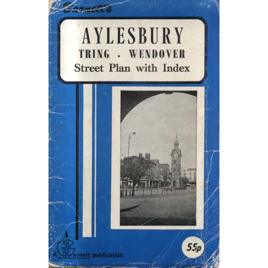
The wonderfully period blue Garnett cover, complete with a black-and-white town-centre photograph and original 55p price, adds considerable nostalgic appeal. It recalls an age when a street guide was an essential item in the glove compartment, alongside a road atlas, a torch with unreliable batteries and a collection of parking tickets.
This copy is offered in Fair condition by Crappy Old Books, with visible wear and creasing to the cover, entirely consistent with a publication that may have accompanied numerous journeys through the highways and byways of Buckinghamshire and Hertfordshire.
An appealing piece of local cartographic history for vintage map enthusiasts, residents, former residents and anyone interested in the changing geography of these three towns.
And a reminder that before satellite navigation, finding an unfamiliar address required patience, observation and a willingness to admit that you were lost.
Unless you were a man driving with his wife in the passenger seat.
In which case, of course, you were merely taking the scenic route.
Keep browsing: See more Maps books Other books by Garnett
